Hi,
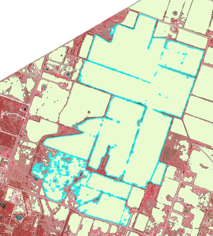
I’m using ArcGIS Pro version 3.2.2 in Windows 10. I’ve created a deep learning model using HED as backbone model. It’s working well. My problem is the final polygon output. Some of the polygons are sticking together because sometimes, the satellite image doesn’t have clear boundary lines. See this sample output:
Does anyone know how I can split this up without doing it manually? There are several of these in a very large project and I can’t do it manually for every instance. I wonder if there’s some tool that can “infer” when to split a large polygon like this based on the edges.
I’ve done Boundary Clean before using Raster to Polygon tool. Still, I get this kind of situation.
Appreciate any suggestions.

