 Getty Images
From planting trees to painting streets white, US cities are fighting extreme heat.
“The opportunities for heat mitigation in the US are huge,” says Steffen Lehmann, director of the University of Nevada’s Urban Futures Lab. “The knowledge is there, but the things that need to be done are not being done. It is extremely frustrating.”
 Getty Images
Around 80% of America’s population lives in urban areas – where the heat island effect can drastically worsen the impact of hot weather. Urban heat islands are densely populated, built up areas with few trees and large areas of dark concrete and asphalt that absorb the sun’s energy. As the sun goes down, the manmade materials release the stored heat – ensuring that the city stays hot, even at night. Urban heat island temperatures can be up to 11C (20F) hotter than less populated areas.
As US cities continue to experience record-breaking, life-threatening triple-digit days, researchers like Lehmann say many areas are still underprepared. In 2022, a group of scientists examined 175 municipal city plans from the 50 most populous cities in the US. Although the majority mentioned heat, “few included” strategies to address it, the report found.
“If cities are not painting a complete picture of heat — how chronic it is, and its disparate impacts on the ground — we’re not going to be able to fully protect residents, and we could end up exacerbating existing social and environmental injustices,” says co-author Emma French, a doctoral student in urban planning at University College of Los Angeles.
Another study found 41 million people live in areas with extreme urban heat island temperatures. The report, by Climate Central, found 14 cities had an extreme contrast between temperatures in urban areas versus surrounding less-developed areas. These included Albuquerque, Bakersfield, Fresno and Las Vegas.
The problem is “too much talking and not enough action”, Lehmann says. “It’s extremely difficult to effect change.” It is hard to hold one city up as a model case study when it comes to heat mitigation, Lehmann continues, because there’s nowhere in the US doing it well.
“But”, he continues, “I am optimistic. Because there are things cities can do to cool down. And I do think there is a mindset-change happening.”
Green over grey
 Getty Images
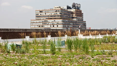
In Tuscon, Arizona, drought makes tree-planting even harder in low-income neighbourhoods, where residents often can’t afford to plant or maintain trees in their gardens. The city runs a rebate programme to reimburse residents up to $2,000 (£1,563) for installing rainwater collection systems, where the water could be used for trees and green areas. This includes zero-interest loans and grants for economically challenged communities, as well as providing workshops in Spanish.
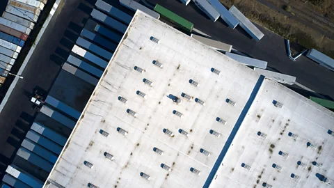
Paint it white
 Getty Images
Data-gathering plays an important role in planning for the future when it comes to heat.
In 2022, 60 volunteers measured the morning, afternoon and evening temperatures across Clark County, where Las Vegas sits, as part of a National Oceanic and Atmospheric Administration-funded heat mapping study. The map produced from that data shows that elevated temperatures are worst in North Las Vegas, East Las Vegas and downtown, which can get up to 6C (11F) hotter than other parts of the city. The county is now using the data to inform heat mitigation policies which include community cooling centres and tree-planting initiatives.
In Albuquerque, New Mexico, the city worked with local volunteers to map temperature and humidity by handing out specially-designed thermal sensors. Residents drove or bicycled around prescribed routes twice daily to record more than 67,000 temperature points. The maps showed differences of up to almost 9.4C (17F) in different portions of the city, with hottest temperatures in downtown and neighbourhoods adjacent to highways. Again, the neighbourhoods worst affected were low-income communities. The city then teamed up with Nasa to take satellite images, which were overlaid with social vulnerability data to target frontline communities.
The city had never done something like this before, and the data allowed the city government to plan for heat accordingly, according to who needed help the most. “It led to two important strategies we’re implementing right now,” says Albuquerque’s sustainability officer Ann Simon. One is a community energy-efficiency programme, where low-income families are helped to maximise their energy efficiency in their home and lower their energy bills by around £233 ($300) a year. To date, the city has made improvements in 104 homes.
“We’re a small programme but we did just receive a large $2 million grant to help more families so we can help the number of families we serve by sixfold,” says Simon.
Nasa will also be imaging the neighbourhoods again, which Simon hopes will inform future planning.
Planning for the future
“Just a couple of years ago, very few cities were talking about preparing for rising temperatures, so it’s an important step that heat is becoming a larger part of the conversation,” says V. Kelly Turner, professor of urban planning and co-director of the University of California’s Los Angeles Luskin Centre for Innovation.
Lehmann been working with Las Vegas city officials for the past six years developing a master plan for how to cool the city by 2050. In 2021, the city’s Clark County released its 2050 Master Plan, which features plans to mitigate heat. Planting low maintenance and drought-tolerant plants to provide shade, reducing hardscaped areas, and designing buildings that provide shade are just some of the policies laid out. “But I believe we’ll see change,” says Lehmann, “now that the city wants it.”
Las Vegas has already started on other initiatives, such as opening public cooling stations for the homeless during heatwaves, and beginning a project to plant 60,000 trees by 2050 to provide shade. At the parking lot of a large basketball stadium, 1,000 parking spaces are being removed in order to plant 1,000 trees. It’s a controversial move though, says Lehmann, in a city that is so car-dependent. The city is also working with engineers at the University of Vegas to develop a reflective roof coating for the hundreds of casinos and hotels in Las Vegas – but its application will be voluntary, Lehmann notes.
As always, it comes down to implementing a multitude of solutions, and thinking outside the box. Despite his frustrations, Lehmann remains positive. “As architects, our job is to reimagine the future,” he says. “I don’t need to see what Las Vegas looks like now, I need to see what it looks like in 20 years time.”
