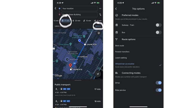
Google Maps has a dedicated feature that shows you transit routes that are accessible via wheelchair. All you have to do is put your destination on the app, tap Directions, click on the transit icon, and then tap Options on the top right corner of the map. Under Route options, click on Wheelchair accessible and go back to the map. You’ll now see different transit routes based on accessibility.
The Route options tab also offers other helpful stuff. You can choose from Best route, Fewest transfers, and Least walking based on your top priority.